

Tensleep Canyon
Written by: Laurel Thompson
Spring, the season of rejuvenation, is a very special time in the Bighorn Basin. For outdoor enthusiasts, we begin the transition of seasons by holding onto the last powder covered hills and trees of the trails we have enjoyed cross country skiing or snowshoeing the past few months of winter. But as the snow continues to melt, and the days become brighter and warmer, our beloved winter gear finds its way into dark cabinets and cupboards as the excitement of spring begins to buzz in the air.
Exposed grass begins to turn green. The chirps of birds and squirrels return to our yards and forests. And rivers and creeks flow freely as the last remnants of snow and ice drift away. Even the wildlife seems to become more chipper as the harsh winter days fade and our surroundings jolt back to life.


Springtime Dreams
In our household, spring is a time for stretching our legs on the first snowless hikes of the season, horseback riding, trout fishing, and dreaming of high-country pack trips and other upcoming adventures. One of our favorite areas to explore in mid to late spring is Tensleep Canyon and the surrounding National Forest – Bighorn National Forest.
A House Divided
Ten Sleep, Wyoming, a small town with less than two hundred and ten residents, is in the south west corner of the Bighorn Basin along the western foothills of the Bighorn Mountains. If you have not been to this tiny mountain town, you will want to be sure to stop by their local barn brewery, Ten Sleep Brewing (a must for me), or one of their several main street eateries such as the Sleepy Coyote, or even pick up ice cream from the rustic general store, Dirty Sally’s (a must for Sam).


Head to the Clouds
From town, you will head east on US 16, also known as the Cloud Peak Skyway Scenic Byway, towards Buffalo, Wyoming. Cloud Peak Skyway Scenic Byway (CPSSB) stretches forty-seven miles between the Bighorn National Forest boundaries, taking you over Powder River Pass at its peak elevation. But before you reach the top, you will want to take in the sights and sounds along the way!
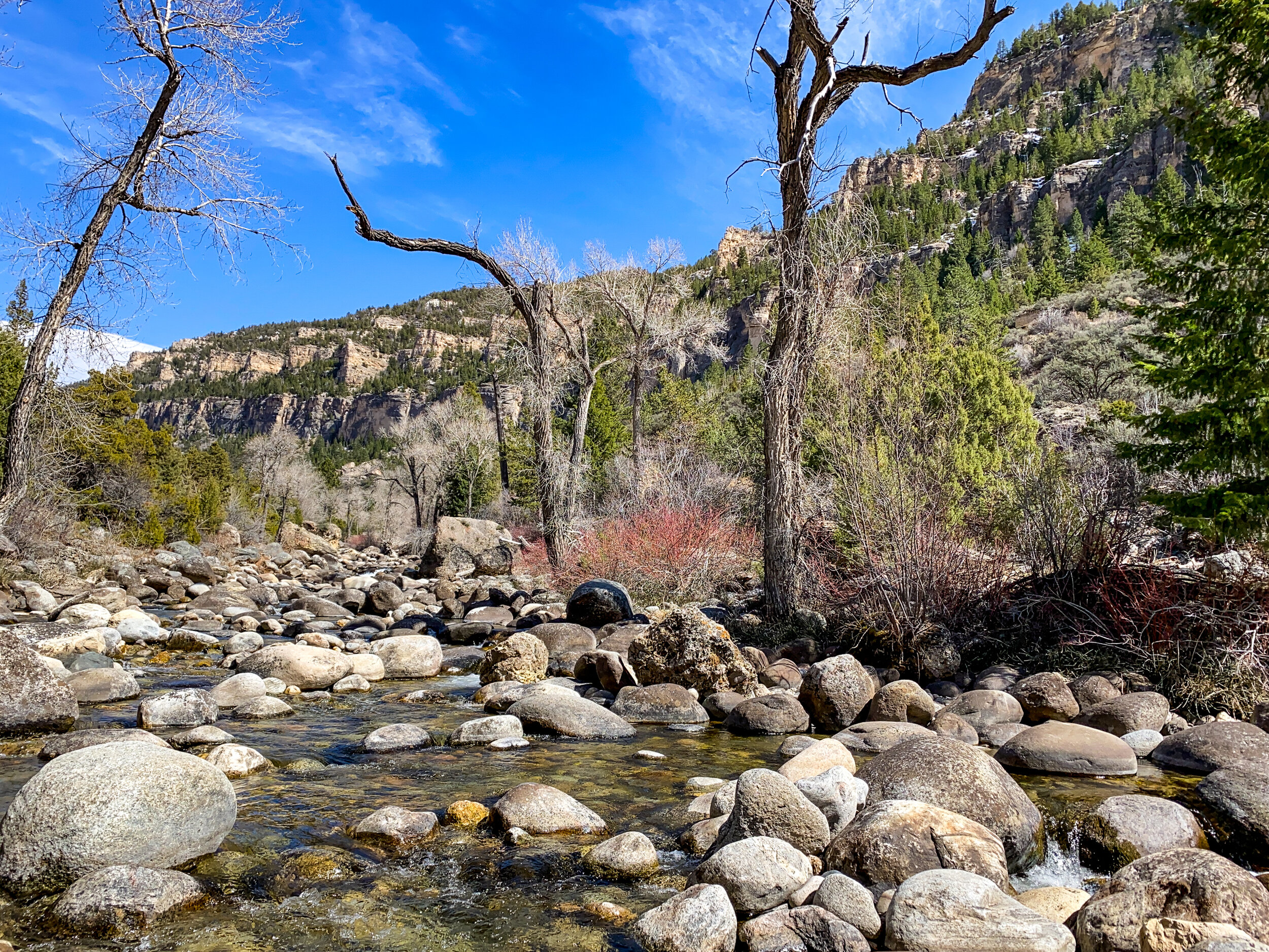
US 16 is a breathtaking drive that follows the glacier carved curves of Tensleep Canyon.
The rocky, jagged faces were formed within the last two hundred and fifty thousand years by glaciers and continue to be worn away by weather and Tensleep Creek at the valley’s floor (fs.usda.gov). If you are interested in the geology and history of Tensleep Canyon, be sure to stop by the Interpretative Sites on the way up. These are located right off the highway and will be accompanied by a vehicle pull-off.
Recreating in the Canyon
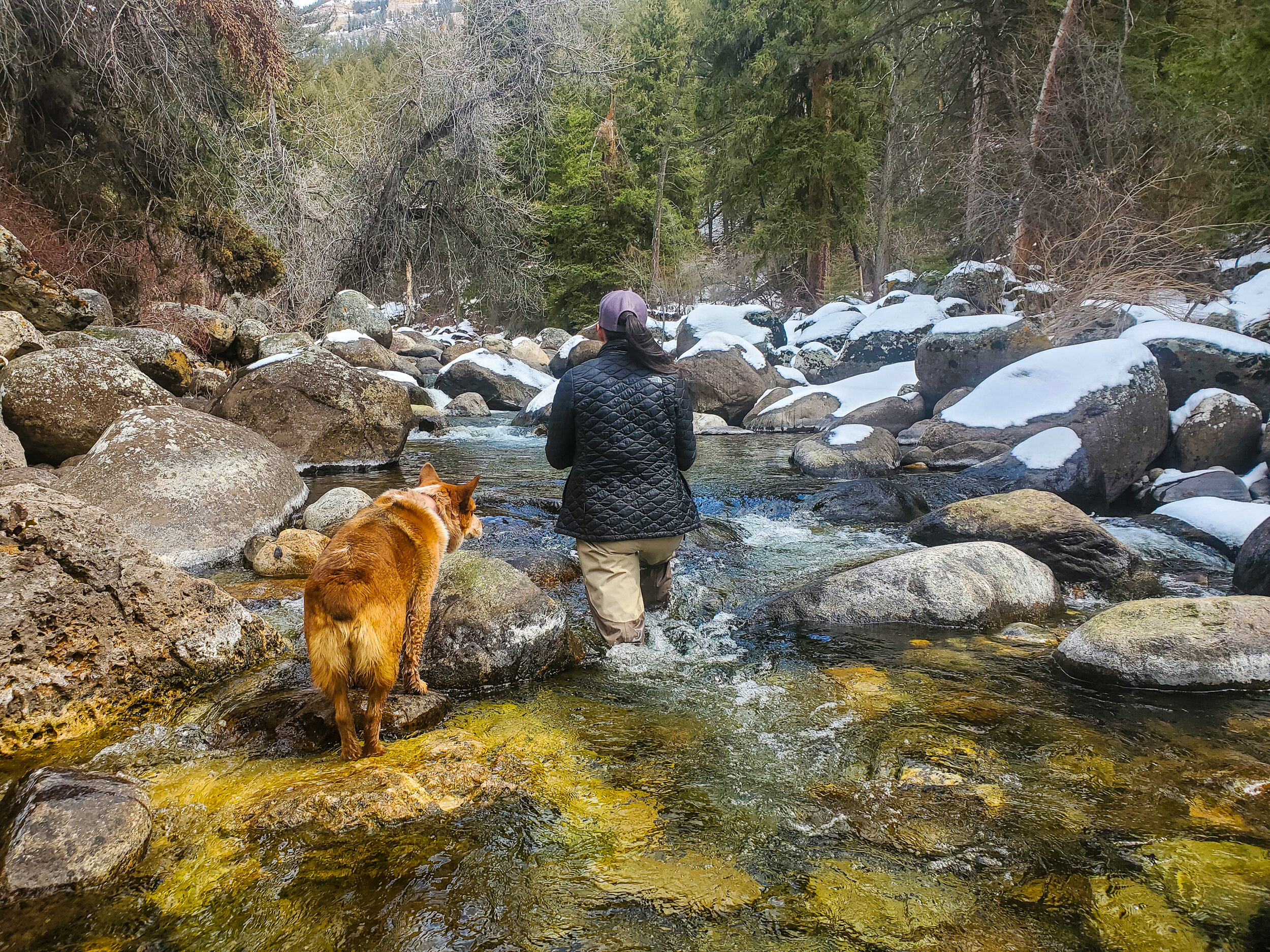
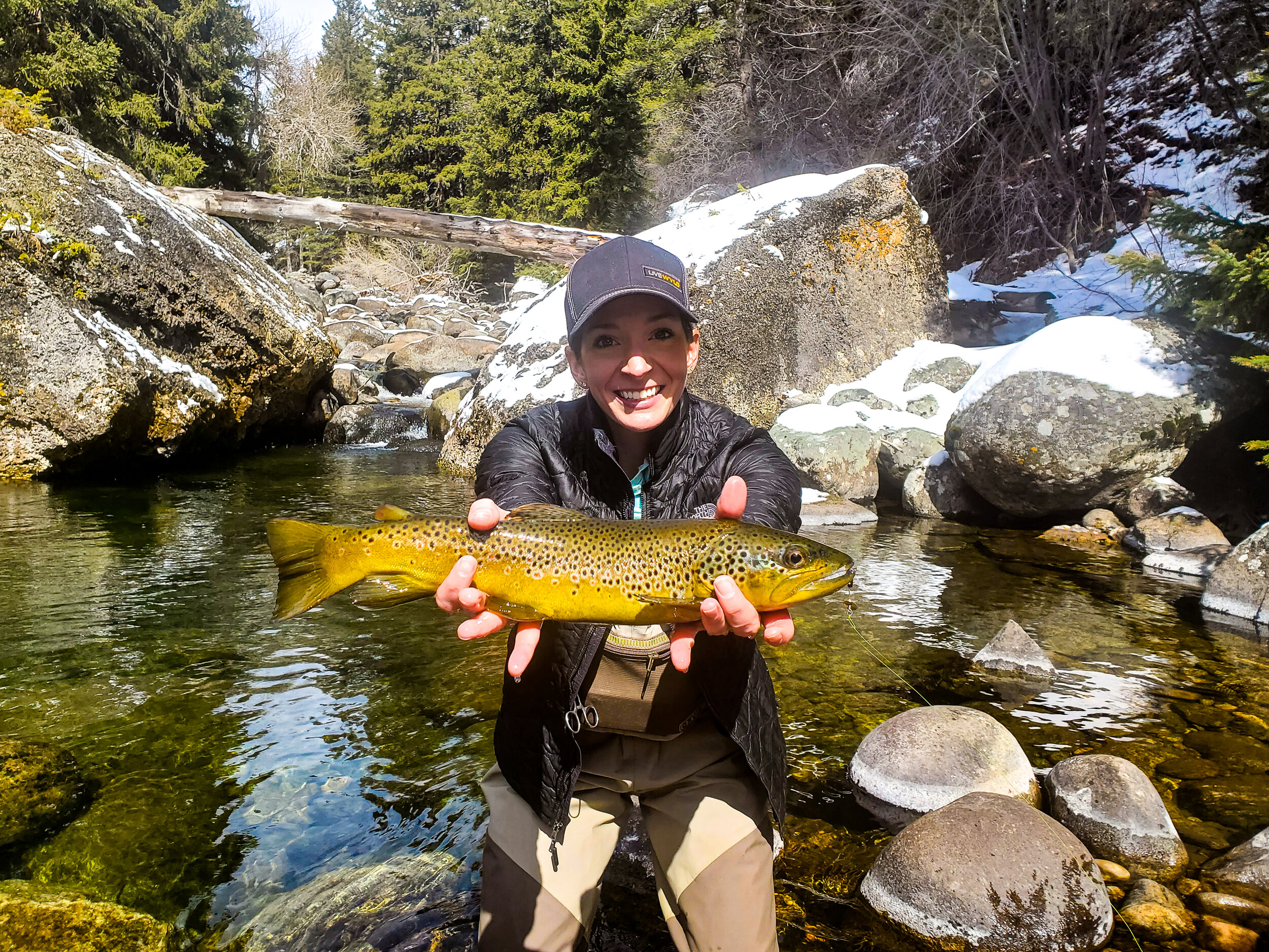
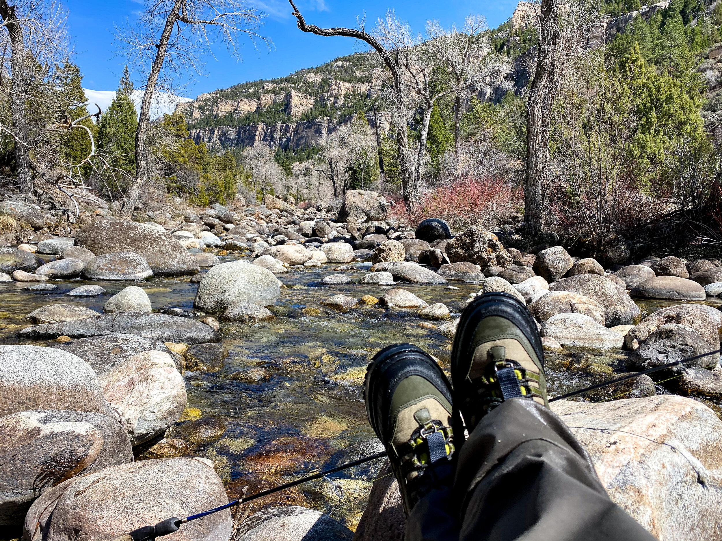
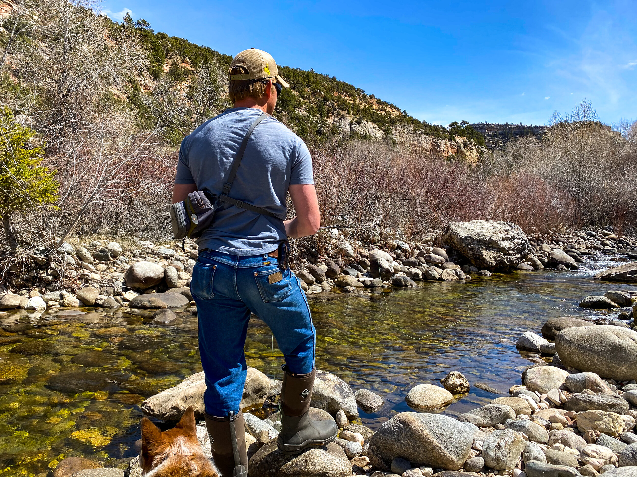
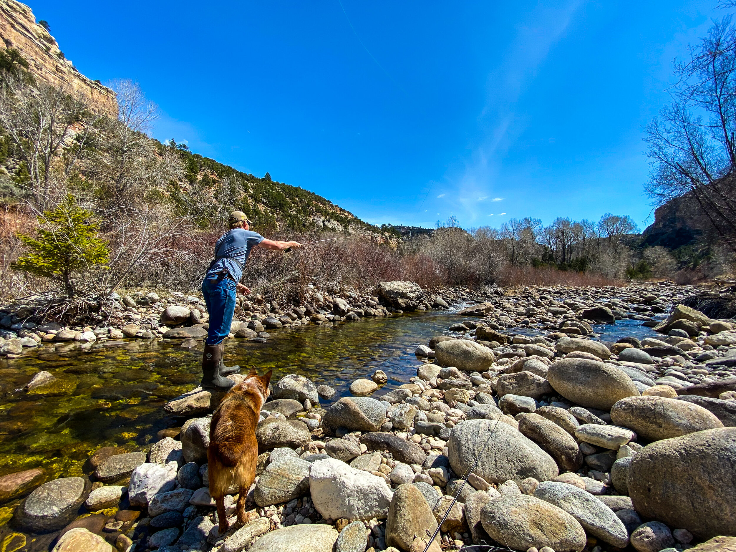
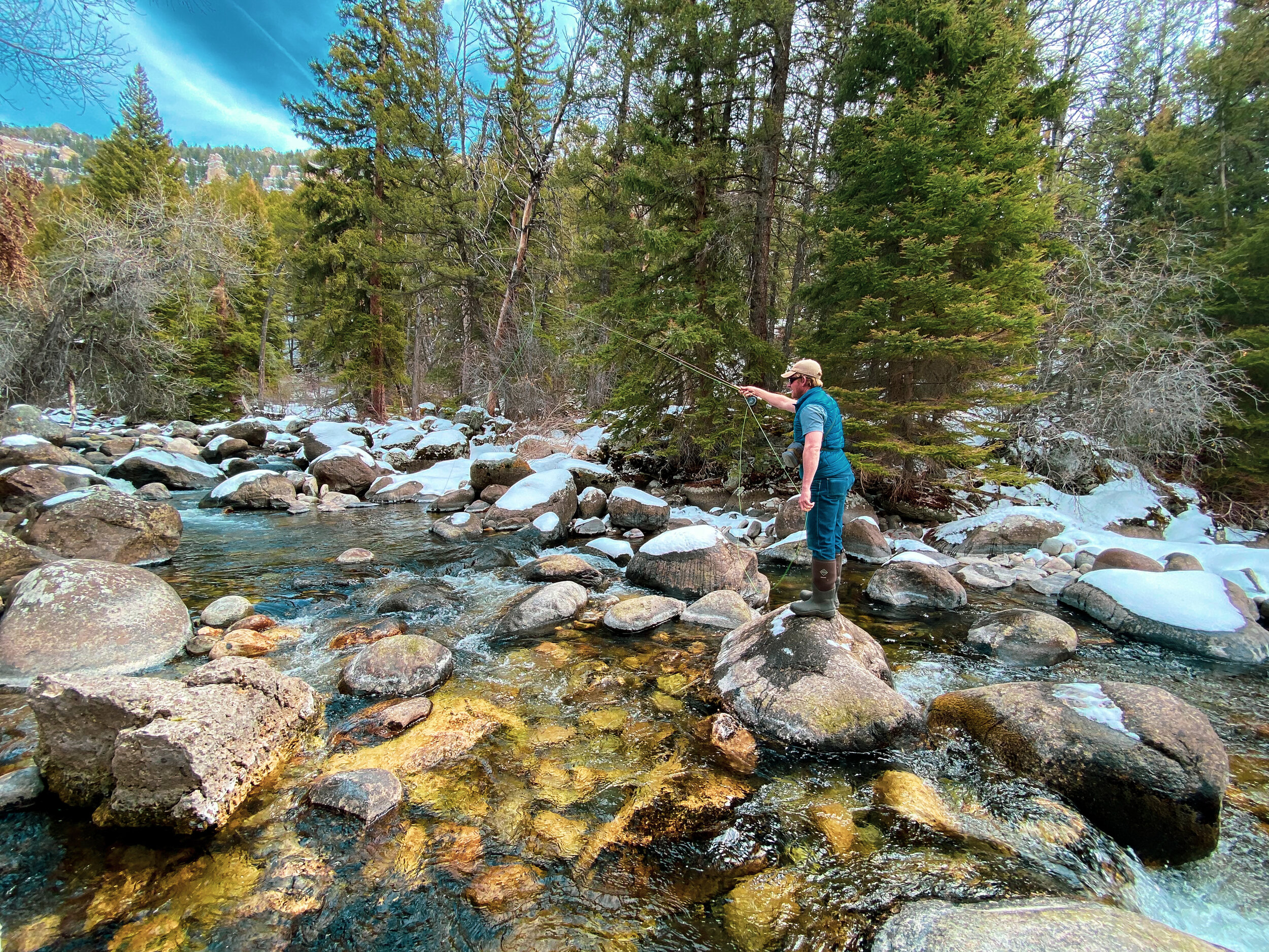
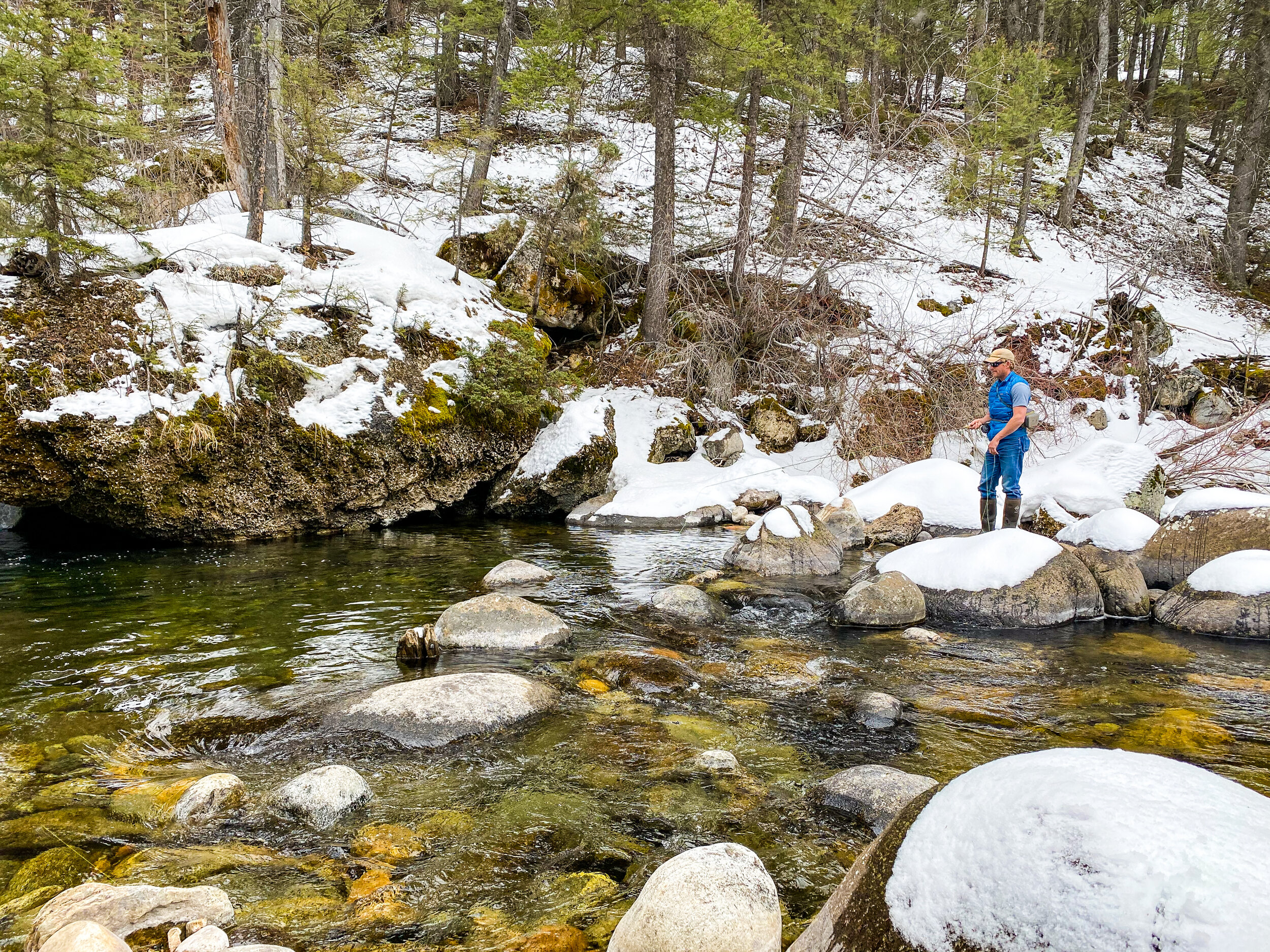
As you enter the canyon, you’ll notice there are several public access points for picnicking, fishing, camping, and hiking including Burke Access Station, Wigwam Rearing Station, Tensleep Camping Area, and Salt lick Trailhead. Sam and I often pull over near the Wigwam access point and walk the creek up fishing for trout and searching for signs of resident deer and beaver.
Further up the Canyon, you’ll run into Leigh Creek Campground, Leigh Monument, several observation pull-offs, and the Tensleep Canyon Climbing Area for our more adventurous readers! The scenery is spectacular, and we highly suggest pulling over for some great photo opportunities! Keep your eyes peeled for the local moose and elk populations too.

Fishing…or Rock Climbing
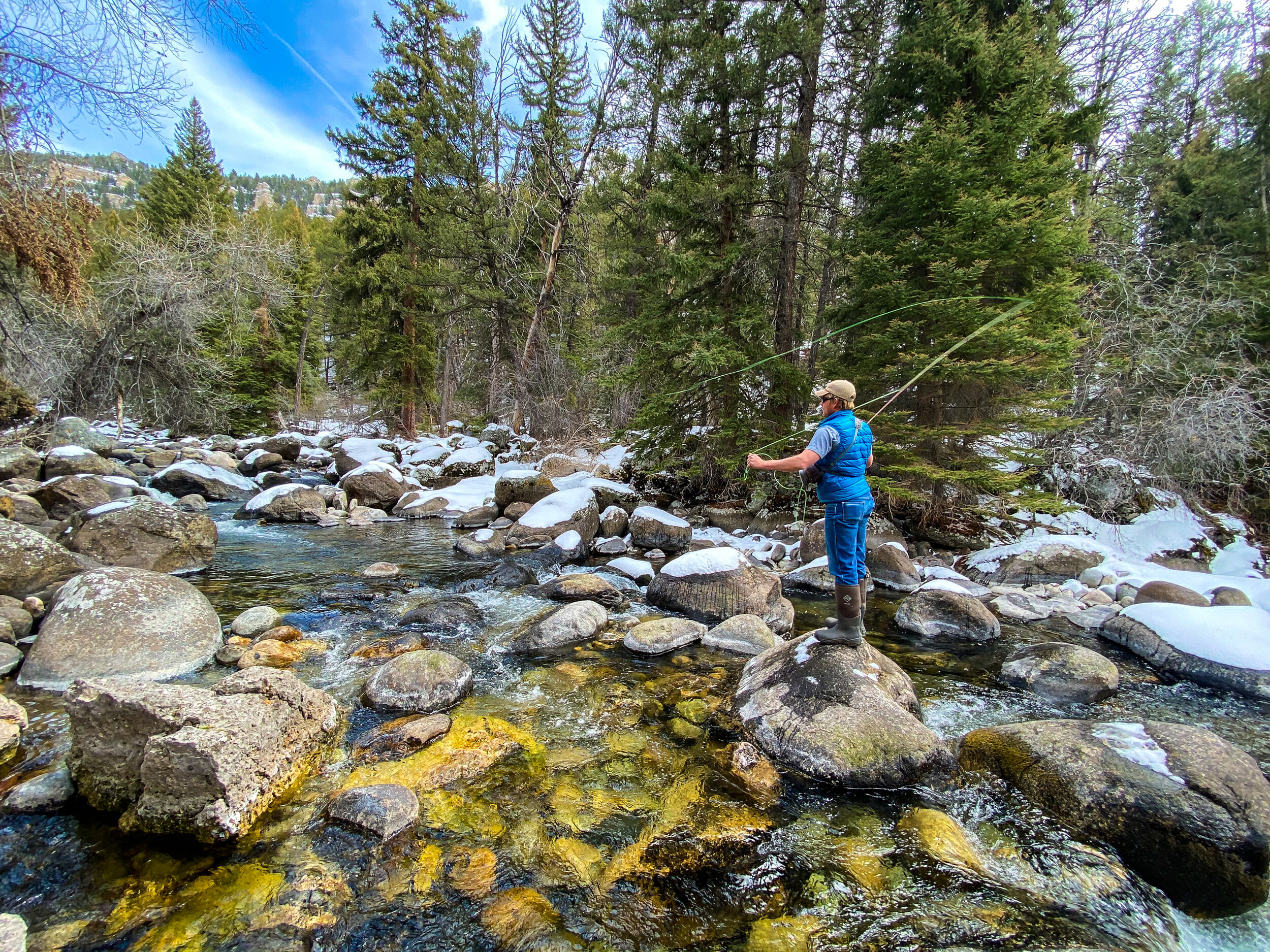
When we last visited this beloved area in mid-April, the creek was still very low. It is fascinating to see the giant, exposed boulders that line the creek banks and bed. Getting around in certain areas can be tricky, but even our red heeler Pepper embraces her inner rock climber! As we made it further up the creek, many of the conifer shaded areas still held ice and snow. The creek water was crystal clear and still quite cold!
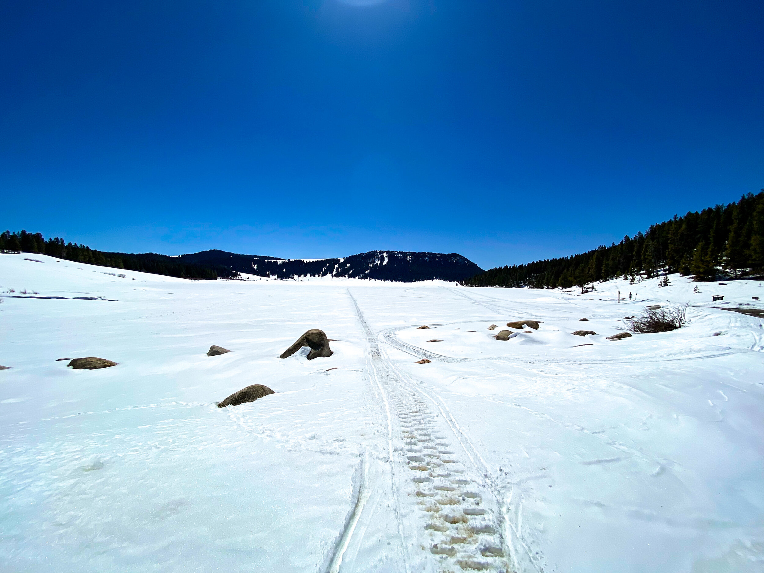
Summer Paradise
While still covered under feet of snow during our April visit, once you climb out of Tensleep Canyon, you’ll find yourself at Meadowlark Lake. The surrounding area is home to tons of campgrounds, trailheads, boat ramps, fishing access, picnic areas, and several smaller lakes – all of which are only a few miles away from Cloud Peak Wilderness.
Bighorn Mountain Bucket List
If you have not had the pleasure of visiting, Cloud Peak Wilderness is one of the most beautiful areas in North Central Wyoming. Named after the tallest peak in the Bighorn Mountain Range – Cloud Peak standing at 13,167 – Cloud Peak Wilderness stretches twenty-seven miles along the middle of the Bighorn Mountains and encompasses over one hundred and eighty-nine thousand acres.
The wilderness area is home to hundreds of lakes and streams and over a hundred miles of trails throughout its lush meadows and deep spruce and pine forests. Thousands of hikers, backpackers, and horseback riders visit Cloud Peak Wilderness annually; all visitors entering the wilderness area are required to complete and submit a registration form. All visitors are asked to use “leave no trace” techniques to help preserve this wild and untouched corner of our state. This is a Bighorn Mountain must if you ask us!
Get Outside and Live WYld
As spring continues full speed ahead and we continue to gain access to areas cutoff by the winter snow, be sure to get outside and explore new areas! Whether you are taking a day trip up the Cloud Peak Scenic Byway or planning your next overnight camping adventure at Sitting Bull Campground, take advantage of the sunshine and Live WYld.